

FIND YOUR TRAIL
The paths around Black Mountain range from gentle lakeside loops to serious ridgeline climbs. Wander at your own pace, and let the mountain decide how hard you'll work for the view ahead.
A NOTE BEFORE YOU GO
Trails shift with the seasons, and heavy rain can wash out a route or swell a creek crossing. Check AllTrails or TrailLink before you head out — or text us, and we'll share what we know.
Choose your difficulty level.

.jpg)
.jpg)
For more hikes and local insight, we wrote up some of the paths less traveled around Black Mountain.
Easy Hikes

Old Trestle Road & Old Mitchell Toll Road
📍Distance from Black Mountain: ~10 min drive (Montreat trailhead)
Time on Trail: Flexible; Toll Road runs ~18 mi one way
Gentle, well-graded roadbeds (the Toll Road was once driveable by Model T) make these connectors more relaxed walk than climb. Great for linking trails into a custom loop or covering ground away from the crowds.
.jpg)
Point Lookout Trail
📍Distance from Black Mountain: ~10 min drive (Ridgecrest/Kitsuma end)
Time on Trail: ~2–3 hrs (3.6 mi one way); faster by bike
A paved greenway running 3.6 miles between Old Fort and Ridgecrest along old US 70. Gentle, well-graded, and easy on a range of abilities. Bring or rent bikes and let faster riders range ahead while strollers keep an unhurried pace.

Lake Tomahawk Loop
📍Distance from Black Mountain: In town (~5 min drive)
Time on Trail: ~15-20 min (0.5 mi, flat)
A flat, paved half-mile loop around a small lake, right in Black Mountain — benches, mountain views, and an easy pace throughout. Perfect for a quick, low-effort outing with the dog, kids, or anyone who wants scenery without a climb. Do one loop for a short walk, add more to make it longer. That's why it's great for all age groups.
.png)
.jpg)
Craggy Pinnacle
📍Distance from Black Mountain: ~45 min drive (BRP Milepost 364.1)
Time on Trail: 0.5-1 hr (1.4 mi round trip, ~250 ft gain)
One of the Parkway's best views for the least effort. A gentle, rhododendron-tunneled climb leads to a 360° summit panorama reaching all the way to Tennessee. Big payoff for a short walk. Great for sunrise or sunset.
Medium Hikes
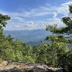
Greybeard Trail
📍Distance from Black Mountain: ~10 min drive (Montreat trailhead)
Time on Trail: 5.5–6 hrs full summit; less to Walker's Knob (~4.5 mi one way)
A rewarding climb along Flat Creek past Graybeard Falls, opening to views of the North Fork watershed. Walker's Knob is a natural turnaround if you don't want the full push. Long enough to filter out the quick-stop crowd.
.jpg)
Trombatore Trail
📍Distance from Black Mountain: ~35–40 min drive (Edneyville access)
Time on Trail: ~3–3.5 hrs (~4.8 mi round trip)
A steady climb from forest into Blue Ridge Pastures, where the landscape opens into rolling hills and wide sky. A different feel from the forested ridges. Great for picnics, wildflowers, and groups. Now connects to Strawberry Gap.

Catawba Falls
📍Distance from Black Mountain: ~20 min drive (I-40 Exit 73, Old Fort)
Time on Trail: ~1.5–2.5 hrs (~2.5 mi round trip; longer with the upper falls tower)
A close, rewarding waterfall hike along the Catawba River headwaters to a 100-ft multi-tiered cascade. Recently reopened with new bridges, stairs, and a 60-ft observation tower. Easy to the base, more of a climb to the upper falls.
_edited.jpg)
Graveyard Fields
📍Distance from Black Mountain: ~1 hr drive (BRP Milepost 418.8)
Time on Trail: ~2–3 hrs (full loop ~3.2 mi; short spur to Lower Falls ~0.6 mi)
A mile-high valley loop past two waterfalls, open meadows, and summer blueberry thickets. Family-friendly with several length options, from a quick Lower Falls spur to the full loop. Popular and scenie. Arrive early on weekends.
Hard Hikes
West Ridge Trail ("Seven Sisters")
📍Distance from Black Mountain: ~10 min drive (Montreat trailhead)
Time on Trail: Full day (~2.7 mi one way, strenuous)
A ridgeline route through a sequence of peaks building toward Graybeard. Less about distance, more about terrain. Steady elevation changes, narrow sections, and an exposed feel. Quieter and continuous, for experienced hikers wanting an immersive day.